Photogrammetry Samples
Photogrammetry is amazingly cool analysis tool that can be applied to images captured using drones.
This processing technique can be used to combine many photos to create an ortho-mosaic image, point cloud data and/or a 3D model.
For the most efficient capture of images, and to provide the best models, software is usually run to fly the drone along a pre-planned (lawnmower or gridded) path. Next generation software may be just around the corner (from Skydio) to automatically scan an object in low resolution during a flight, then automatically both plan and execute an optimal flight path to image it at a high resolution. This will be really cool.
Here are a few sample datasets I’ve captured for fun and to play with photogrammetry. They were flown with various flight paths that are FAR from optimal. Much better flight paths would image each spot on the object in at least 5 images from different angles. Such images would produce much better 3D models. I hope to use the Drone Deploy flight App soon with my Skydio 2 to fly some mapping missions.
Please note that the 3D models and the video files referenced in the tables below are large. Therefore I recommend that you download them to your computer before viewing them. Once you click a link you will see the file (or files) listed. Right click on any listed file and select “Save link as…” to download the file to your computer. You can then play the downloaded (.mp4) video file without having it buffer. You can also view the 3D model (simply from within a web browser). To do that, go to the site https://sandbox.babylonjs.com and then drag the downloaded 3D model (.glb) file into the BabylonJS viewer in that browser window. This free BabylonJS sandbox viewer is really cool. Check out some YouTube videos on how to access the Inspector in the Sandbox to adjust the visualization to get more satisfaction during viewing the models.
| A Walk in the Park – Orbiting while Tracking | |
| This dataset contains a scene that was captured automatically while a subject was being tracked. I hadn’t heard of anyone doing this with the Skydio 2 drone (as of 3/7/2021) so I thought I would give it a try. This was my first attempt. The Skydio 2 drone was flown using the beacon controller that was set to orbit me as I walked down a path through a park. This method of capture is really cool as anyone with this drone can capture images like this while they are out on their adventures. No specialized mapping software is required to capture the images (just photogrammetry software to process them later). Another cool benefit of using this approach is that the area to map does not need to be pre-defined. It is simply defined as you move around. During this capture, I was walking so my position changed with every image. Thus, the 3D model does not show me. Images were captured every 2 seconds and a subset of them were selected for analysis. The images were processed using Agisoft Metashape. A dense point cloud was used and a 3d mesh was created. Computer processing power (my ~10 year old computer with an i7-2600K processor, 16GB of RAM and an Nvidia GTX 1660 6GB card) limited the size of the point cloud I could use in the processing step to reconstruct the 3D model so I trimmed the point cloud to an irregular region around the path and reduced the 3D model generation region size before doing the processing. The video linked below shows several visualizations that were created from the data. The source images are provided so you have the option to download and then process them yourself with your photogrammetry software of choice. The 3D model can be downloaded to your computer and then visualized using a web browser and the BabylonJS sandbox. On December 17, 2024 I processed the imagery into a Gaussian Splatting model. The .ply model can be downloaded as can a .zip file containing the aligned cameras exported from Agisoft Metashape in Colemap format. |
|
| Drone: Skydio 2 | 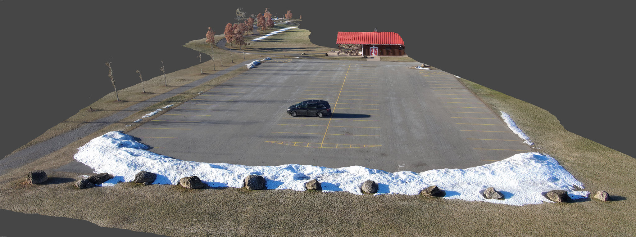 |
| Source Images Link | |
| 3D Model Download Link (169MB) | |
| Watch on Youtube | |
| Gaussian Splatting | |
| Ice Formations at Seabreeze Pier | |
| This set of 91 images was acquired in a manual flight with a controller. Images were captured every 2 seconds and a subset of them were selected for analysis. The flight wasn’t designed or flown for photogrammetry processing. The images were processed using Agisoft Metashape. A medium dense point cloud was used and a 2.5d mesh was created. The video linked below shows a visualization of the model that shows the camera positions which highlights that the flight was not designed as a mapping mission. The source images are provided so you have the option to download and then process them yourself with your photogrammetry software of choice. |
|
| Drone: Skydio 2 | 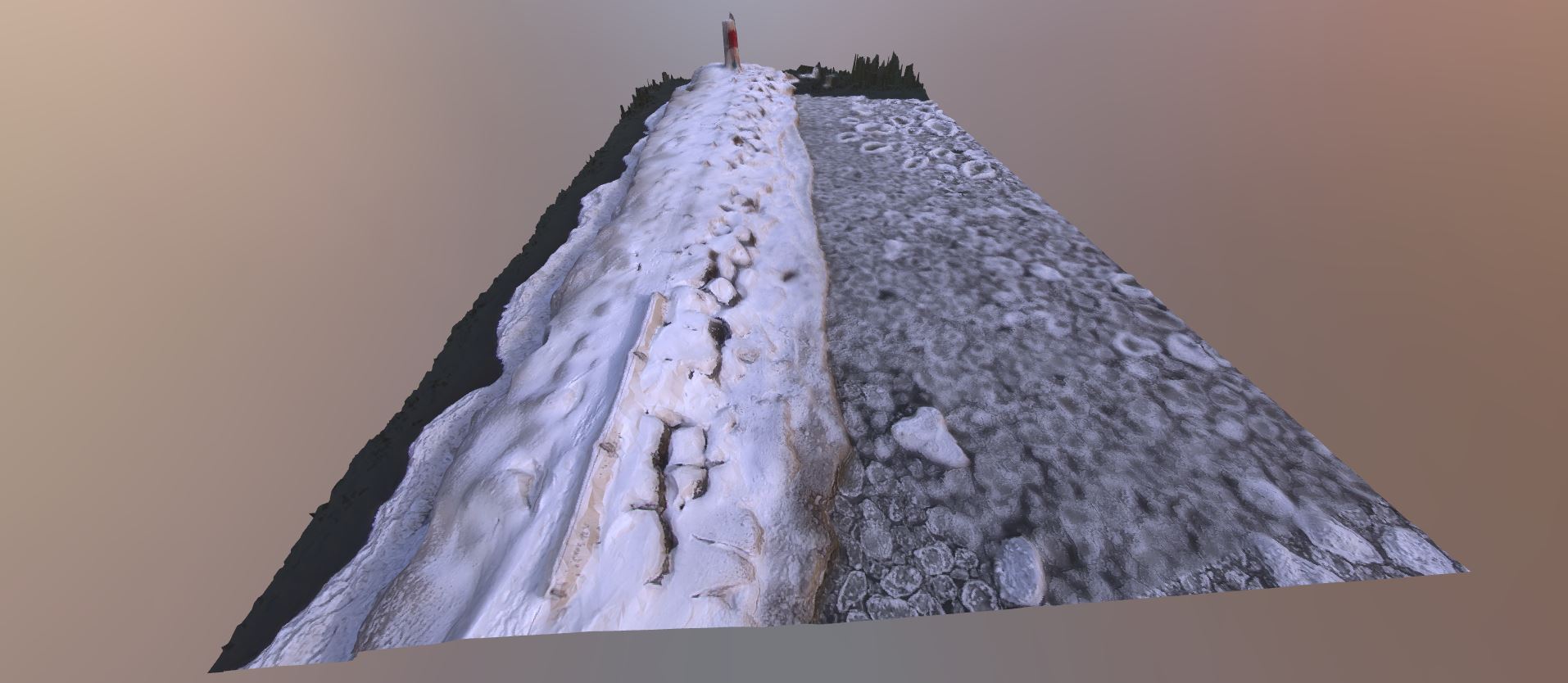 |
| Source Images Link | |
| 3D Model Download Link (33MB) | |
| Watch on Youtube or Highest Quality Video Download Link (warning 472MB) |
|
| Hiking at High Tor | |
| This set of images was originally acquired as a video with the drone flying in an automated orbit path. Images were then extracted from the video for photogrammetry analysis. The flight wasn’t designed or flown for photogrammetry processing. The images were processed using Agisoft Metashape. A dense point cloud was used and a 3d mesh was created. The video linked below shows a visualization of the model that shows the camera positions which highlights that the flight was not designed as a mapping mission. The source images are provided so you have the option to download and then process them yourself with your photogrammetry software of choice. |
|
| Drone: Skydio 2 | 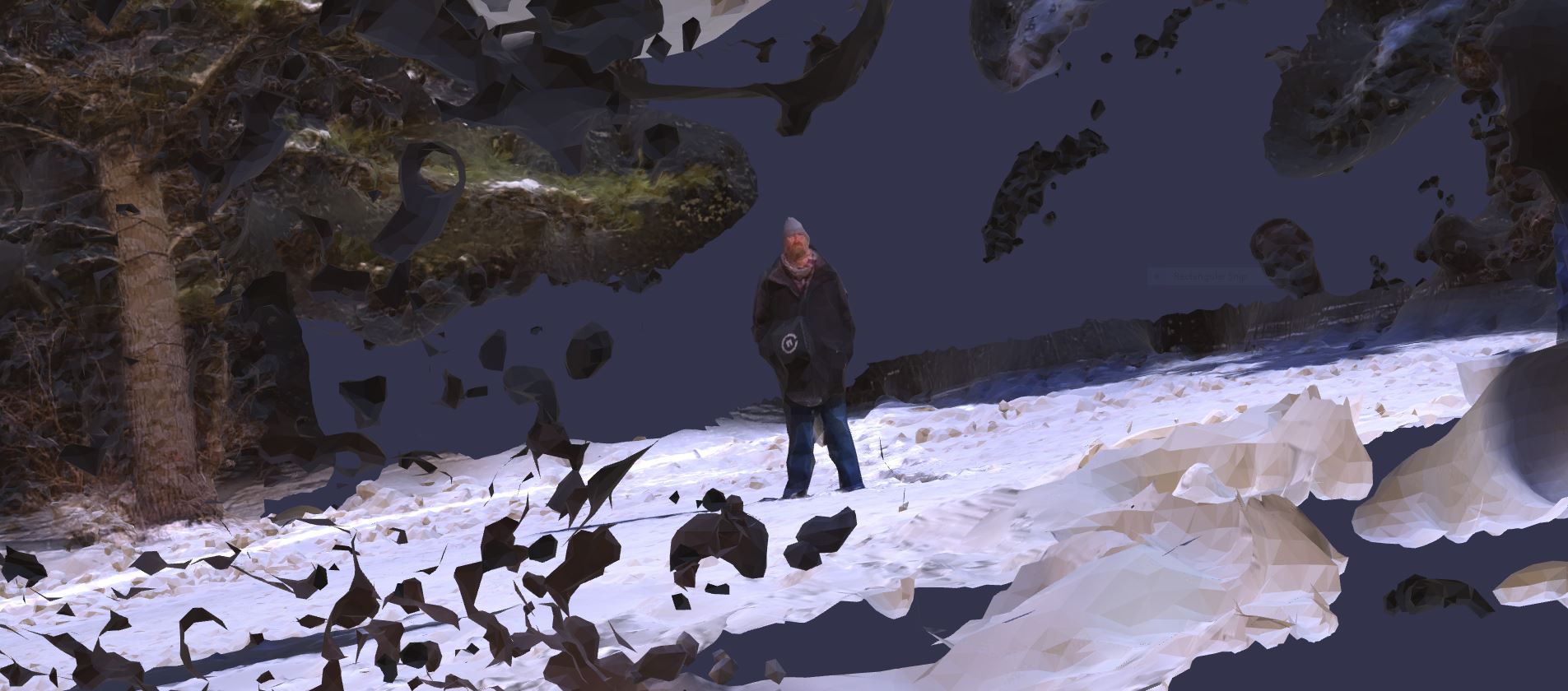 |
| Source Images Link | |
| 3D Model Download Link (55MB) | |
| Watch on Youtube or Highest Quality Video Download Link (warning 215MB) |
|
| House In the Snow | |
| This model was created from a set of 393 images that were captured during a manual flight with a controller. Images were captured every 2 seconds. The images were processed using Agisoft Metashape. A dense point cloud was used and a 3d mesh was created. The video linked below shows a visualization of the model that shows it first without the camera positions and then with the camera positions. This illustrates how difficult it can be for a newbie pilot to manually fly a mapping mission in 20 degree F weather. Some portions of the model look good while other areas have large holes. The flight should have also covered the left side of the house. The fence on this property is very hard to model well. It may be because it is solid but also so thin. The source images are provided so you have the option to download and then process them yourself with your photogrammetry software of choice. | |
| Drone: Skydio 2 | 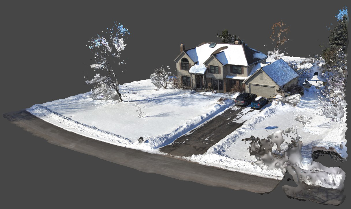 |
| Source Images Link | |
| 3D Model Download Link (85MB) | |
| Watch on Youtube or Highest Quality Video Download Link (warning 472MB) |
|
| White Lady’s Castle | |
| This model was created from a set of 219 images that were captured during a manual flight with the controller. The images were processed using Agisoft Metashape. A dense point cloud was used and a 3d textured mesh was created. With all of the leafless trees, I cut the stone wall out before applying mesh processing. The source images are provided so you have the option to download and then process them yourself with your photogrammetry software of choice. | |
| Drone: Skydio 2 |  |
| Source Images Link | |
| 3D Model Download Link (70MB) | |
| PHS Senior Parking Lot Painting | |
| This model was created from a set of 412 images that were captured during a flight using Drone Deploy. The altitude was 50 feet for the 11 and 1/2 minute flight. The images were processed using Agisoft Metashape. A dense point cloud was created and a 2.5d textured mesh was created with a orthophoto texture. A 16384×16384 JPG format image was also created to show a single high-resolution view of the paring lot area containing the painted parking spaces. If you download the 3D model to your computer, you can drag it into the Babylong Sandbox viewer and navigate around the scene in 3D (2.5 dimensions). | |
| Drone: Skydio 2 |  |
| Full-resolution composite image. [256 Megapixels] (43MB) | |
| 3D Model Download Link (137MB) Just download the model. Go to https://sandbox.babylonjs.com and then drag the downloaded file into that web page viewer. | |
| Low resolution video. (263MB) The Skydio 2 drone shoots low resolution video even while running in photo mode. Watch the trees in the first minute of the flight. A little scary to watch! | |